Habsburg Empire Map [ENG]
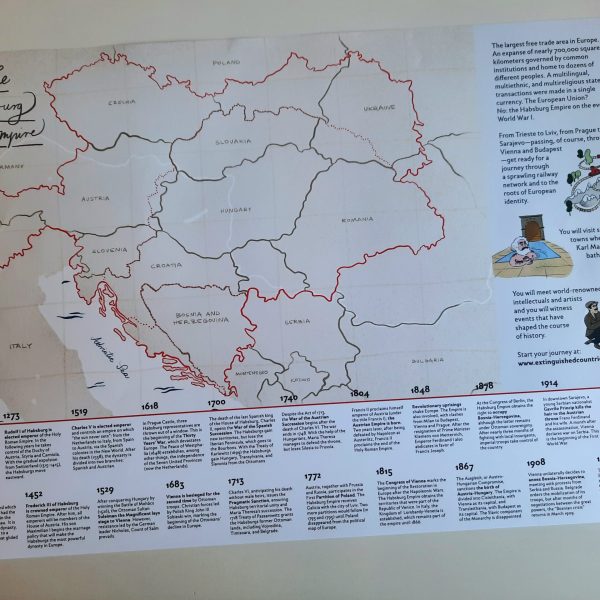
7,00 €A3 poster map of the Austro-Hungarian Empire in 1914, featuring today’s borders and the historical frontiers (including a dashed red line dividing Cisleithania and Transleithania). Enriched with a timeline of 20 key events in Habsburg history and original illustrations from the book. Dimensions: 40,8 cm x 28,2 cm