Bookmark
3,00 €Extinguished Countries bookmark featuring the borders of a vanished state – can you guess which one? The back includes a wishlist space to note down the disappeared countries you’d like to visit. Dimensions: 21 cm x 4,8 cm
Showing all 3 results
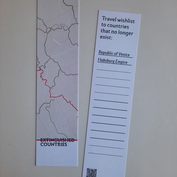
Extinguished Countries bookmark featuring the borders of a vanished state – can you guess which one? The back includes a wishlist space to note down the disappeared countries you’d like to visit. Dimensions: 21 cm x 4,8 cm
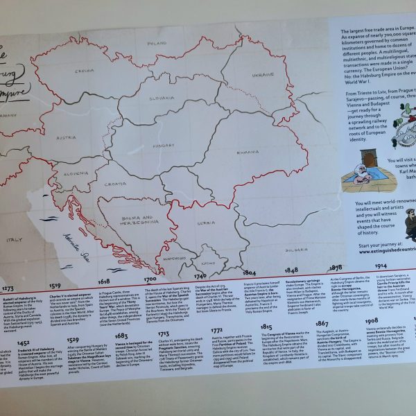
A3 poster map of the Austro-Hungarian Empire in 1914, featuring today’s borders and the historical frontiers (including a dashed red line dividing Cisleithania and Transleithania). Enriched with a timeline of 20 key events in Habsburg history and original illustrations from the book. Dimensions: 40,8 cm x 28,2 cm
The largest free trade area in Europe. An expanse of nearly 700,000 square kilometers governed by common institutions and home to dozens of different peoples. A multilingual, multiethnic, and multireligious state where transactions were made in a single currency. The European Union? No: the Habsburg Empire on the eve of World War I. From Trieste…